July 12 – Wildnote: Harnessing Technology to Support Citizen Scientists

Speaker: Kristen Hazard

Kristen Hazard, Wildnote’s founder and chief programmer will share the Wildnote story and give an app overview, while Renee Punzi and Nancy Douglas will talk about Wildnote’s current citizen sciene efforts on the Central Coast.

In 2011, Kristen Hazard, a principal at Terra Verde Environmental Consulting, built an environmental compliance reporting app for the powerhouse utility PG&E. The utility needed to comply with environmental regulations while building the infrastructure to accept power from the two huge solar projects in the Carrizo Plains. The app was so valuable to PG&E it started using it on all large construction projects. Over the last five years, PG&E has utilized the app to submit over 50,000 reports and upload over 300,000 photos from more than 600 users from 30 companies. PG&E continues to use the application to meet its compliance reporting needs.

With this background, Kristen’s company, Suntoucher Software, recently created and launched a new app called Wildnote directed to the broader environmental community. Wildnote creates efficiencies in the process of collecting, managing, and reporting environmental data. This is a powerful tool that supports those who are directly involved in the hard work of collecting and analyzing environmental data. The better data we have, the better decisions we can make.


May 24 – Better science in less time: How the Ocean Health Index is transforming marine science for management

For the past four years, we have dramatically improved how we work with the Ocean Health Index by embracing open data science practices and tools. We now work in a way that is more reproducible, transparent, collaborative, and open, with more emphasis on communication. Our work is more reproducible and streamlined, and more than 20 countries around the world are building off our science and our code to assess ocean health in their own jurisdictions.

We’re sharing our story because at the time we thought this transformation was intimidating, but we are living proof that it’s possible. By describing specific tools and how we incrementally began using them for the Ocean Health Index project, we hope to encourage others in the scientific community to do the same — so we can all produce better science in less time.

Speaker: Julie Stewart Lowndes

Julie is a marine biologist working to bridge science and resource management. In her role as project scientist for the Ocean Health Index, Julie facilitates the adaptation of the OHI+ assessment framework to smaller spatial scales relevant to marine policy. She leads trainings internationally and provides conceptual and technical support for independent OHI assessments.

Prior to joining the Index team, Julie completed her Ph.D dissertation at Stanford University’s Hopkins Marine Station, researching potential effects of the Humboldt squid in the California Current System on coastal fisheries in a changing climate.

May 17: Red fish, blue fish, where are you, fish?

Species distribution data provide the foundation for a wide range of ecological research studies and conservation management decisions. Two major efforts to provide marine species distributions at a global scale are the International Union for Conservation of Nature (IUCN), which provides expert-generated range maps that outline the complete extent of a species’ distribution; and AquaMaps, which provides model-generated species distribution maps that predict areas occupied by the species. Together these databases represent 24,586 species (93.1% within AquaMaps, 16.4% within IUCN), with only 2,330 shared species. Differences in intent and methodology can result in very different predictions of species distributions, which bear important implications for scientists and decision makers who rely upon these datasets when conducting research or informing conservation policy and management actions. We illustrate the scientific and management implications of these tradeoffs by repeating a global analysis of gaps in coverage of marine protected areas, and find significantly different results depending on how the two datasets are used. By highlighting tradeoffs between the two datasets, we hope to encourage increased collaboration between taxa experts and large scale species distribution modeling efforts to further improve these foundational datasets, helping to better inform science and policy recommendations around understanding, managing, and protecting marine biodiversity.

You can explore an interactive web app of our results here: http://ohi-science.nceas.ucsb.edu/plos_marine_rangemaps/

Speaker: Casey O’Hara

Casey is a Researcher at NCEAS with the Ocean Health Index project as well as an educator, environmentalist, engineer, and musician. He studied climate change adaptation and mitigation, coastal marine resources, and environmental communication at UCSB’s Bren School and received his Master’s degree in 2014.  Long prior to Bren, he earned a B.S. and M.S. in Mechanical Engineering from Stanford in 1994.

Feb 22nd – Biocultural approaches to indicator development and use from local to global

Pacific Island communities are facing unprecedented challenges in conserving natural resources and maintaining human well-being. In these place-based communities, biocultural connections, or the integrated social, economic, cultural and environmental linkages between people and nature are widely believed to play a critical role in improving and maintaining the resilience of both human and ecological communities. However, indicators of human or ecological well-being rarely reflect the integrated nature of these systems.

We synthesized information from visioning exercises across multiple Pacific Island archipelagoes (Hawaiʻi, Fiji, Solomon Islands, Marshall Islands) to better understand the perspectives of Pacific Islanders on characteristics of vibrant biocultural landscapes and seascapes. Based on this and a review of the literature, we identified key elements that describe a resilient biocultural state for Pacific Island communities. We are using these elements to identify if and how international sustainability goals capture local perspectives and values. We are also using these key elements to develop a community self-assessment guide. Finally, we are in the process of comparing indicators of biocultural resilience and their drivers across the Pacific Islands. We expect the results of our work will guide practices on sustainability and well-being that better resonate with communities and better reflect important connections between people and nature.

Eleanor Sterling
Chief Conservation Scientist
Center for Biodiversity and Conservation
American Museum of Natural History
200 Central Park West
New York, NY 10024
http://cbc.amnh.org/
sterling@amnh.org


Stacy Jupiter
Wildlife Conservation Society
Associate Conservation Scientist
Fiji Country Program Director
sjupiter@wcs.org


Rachel Dacks
University of Hawaii
rdacks@hawaii.edu

Interactive Tradeoffs to Support Anticipatory Marine Spatial Planning [Wed. Sept.14]

Human use of the oceans is increasingly in conflict with conservation of endangered species. Evaluation of environmental impacts have historically been post hoc; the time and place of human activity is often already proposed before assessment. I describe anticipatory spatial decision support frameworks that highlight tradeoffs between industry and conservation with interactively synchronized map and tradeoff plots for two spatially distinct problems: siting for offshore wind energy development (OWED) and routing for ships to avoid striking whales.

Offshore wind energy development suffers from a lengthy environmental compliance process, estimated to incur a 7 to 10 year permitting timeline in the US. To responsibly and expeditiously evaluate environmental impacts we differentially assess sensitivity of wildlife above the water line in space, and below the water line in time. During long-term OWED operation, birds can collide and be displaced by active turbines. During episodic pre-operation phases, cetaceans are most heavily impacted acoustically by seismic airgun surveys and pile driving. The framework highlights sites in space that are most profitable and least sensitive to birds. For a given site, pre-operation activities are advised by cetacean sensitivity across months of the year that minimize impacts on migratory cetaceans, particularly those of highest conservation concern such as the North Atlantic right whale (Eubalaena Glacialis) in the case of the US Mid-Atlantic study area.

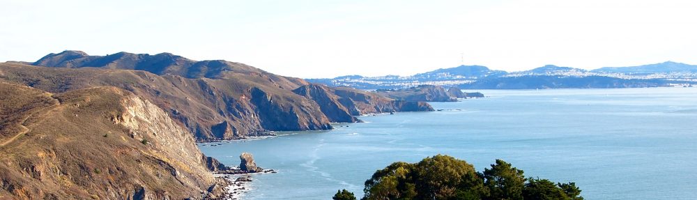
For routing ships to avoid whale strikes, British Columbia is evaluated in light of potential new oil tanker traffic to Port Kitimat where an oil pipeline terminal is under consideration. Marine mammal species distributions are aggregated to a single map layer, weighted by species conservation concern. This map layer of risk to species acts as the resistance surface by which least-cost routing is implemented. Transformations are applied to this surface before the routing algorithm for providing a series of routes offering a range of tradeoffs between conservation and industry. Preemptive avoidance of whale hotspots by ships could theoretically become as commonplace in the oceans as traffic avoidance by cars with Google Maps.
The web-based interfaces are built using the open-source, cross-platform R package shiny. Future developments and broader applications will be discussed.


Ben Best is an environmental data scientist with a strong background in marine spatial ecology. He offers consulting services, current clients of which include the Ocean Health Index and Marine Biodiversity Observation Network. He has lectured at UCSB’s Bren School of Environmental Science & Management for several courses (GIS, Advanced GIS, Landscape Ecology, Environmental Informatics) as well as Duke University’s Nicholas School of the Environment (Marine GIS). He was previously employed as a senior analyst for the Ocean Health Index and research associate for development of the OBIS-SEAMAP marine animal observation geoportal. He recently completed a PhD at Duke University’s Nicholas School from the Marine Geospatial Ecology Lab and obtained an MS in Environmental Sciences from Duke, and from UCSB a BS in Aquatic Biology and BA in Geography.


bbest_pic

Ben Best, Ph.D.
bbest@nceas.ucsb.edu

Translating values over time/space: A continuum approach to reading records and data [Wed. April 27th]

The professional work of data and records creation occurs within a specific context that is bounded by a number of factors. These factors contribute to the shape, form, and other aspects of the data. This discussion will talk about translating and reading co-created data from a particular community of practice, and then turn to a broader conversation about evaluating the context of records.

Soyka16

Heather Soyka
Postdoctoral Research Fellow at DataONE
NCEAS
Santa Barbara, CA 93101
hsoyka@unm.edu

Progress towards developing a fisheries management strategy for data-limited species in Peru (Nov 3)

A majority of fisheries around the world lack the data and/or capacity to be scientifically assessed and managed. Scientifically assessed fish stocks are in better shape than those that are not, with small-scale, unassessed fisheries in worse shape with declining trends. While most of the assessment and management practices have been developed for large-scale, data-rich fisheries, there are many emerging options available for data and capacity limited fisheries. However, there is a challenge in navigating all of the available options, given their differences in data requirements, outputs, costs, and meeting different objectives. To address this, the SNAP Data-limited Fisheries working group is nearing completion of a Decision Support System (DSS) for data- and capacity-limited fisheries. The DSS is a process oriented approach to selecting the three components of a management strategy: 1) a monitoring plan; 2) assessment of the status of the resource; and 3) management decision rules. The DSS allows users to characterize the unique attributes of their fishery through a series of questions, which narrows down the management strategy options to those most cost-effective and relevant to the fishery.

In this round-table, I will present our progress towards applying this framework for a set of data-limited fisheries in Peru: 1) the Lorna Drum (Sciaena deliciosa) fishery; and 2) the Chita (Anisotremus scapularis) fishery. The project will be presented in the context of the Peruvian case study, but I hope this will stimulate discussion around the broader application of this framework and the use of decision support systems.

– – – – –
Dawn Dougherty
NCEAS Data-limited Fisheries SNAP Working Group

What kind of science do we need to create sustainable pathways in the Arctic? (Oct 14)

Globalization processes coupled to the new sea transport routes, resource and infrastructure development and market integration are changing the arctic social-ecological systems at an accelerating pace. The increase in global connectedness will change the local resource-use systems thereby altering landscapes, fish and wildlife populations, and other ecosystem services important to Arctic people. While there is a rich body of research focusing on the direct effects of global warming and adaptions to climate-related changes, we have a limited understanding about how globalization and the adoption of new lifestyles, practices, technologies and institutional innovations could influence causal pathways and sustainability in the Arctic. Despite of these large gaps in understanding, researchers are expected to deliver knowledge that could enable actions and adaptations to environmental changes.

In this roundtable, I hope to spur an informal discussion about what kinds of science are needed and which research gaps we need to fill before providing reliable advice about sustainable pathways. While I will briefly introduce sustainability challenges in the Arctic by presenting the Belmont Forum project CONNECT, this roundtable will benefit from the participants broad experience from research outside the Arctic. I also encourage participants to bring their mobile or laptop in case we will use interactive polling to facilitate discussions (no software need to be installed).

—–
Dr. Vera Helene Hausner
NCEAS Visiting Scientist
Associate Professor in Sustainability Science, UiT-The Arctic University of Norway

NCEAS / UCSB role as the new LTER Network Communications Office (Oct 7)

The National Science Foundation recently awarded the Long Term Ecological Research (LTER) Network Communications Office (NCO) to UCSB and NCEAS (PI Frank Davis; Co-PIs Carol Blanchette, Jenn Caselle, Stacy Rebich Hespanha, Matt Jones, and Mark Schildhauer). The NCO is conceived as an integrated set of activities in three areas – Communication and Outreach, Synthesis Research, and Education and Training – that builds on NCEAS’ longstanding relationship with LTER scientists, leverages existing staff capacity and infrastructure, and takes advantage of UCSB’s strengths and resources in ecology, environmental science and management, environmental communication and media, and environmental informatics.

In this Roundtable I will summarize the key feaures of the NCO and what it will mean for NCEAS, UCSB, and the broader LTER community. I will leave ample time for discussion of NCO needs and priorities.

————–
Frank W. Davis
Director, NCEAS
Professor, Bren School of Environmental Science and Management, UCSB

Introduction to Spatial Analysis in R

Jamie Afflerback (NCEAS Assistant Specialist)
Wed Sept 23
Note location change to Main Conference Room
***
Ever wonder how to work with your spatial data in R? Now’s the time to learn! I will lead an informal, participatory workshop on how to do some spatial analysis in R. This session will use RStudio to introduce some of the most commonly used spatial packages/libraries to work with both raster and vector data types.

Requirements:
– Your own personal laptop
– Familiarity with R and RStudio. This is not an introduction to R so participants should already be using R.
– The most up to date versions of R and RStudio

The workshop is set up to walk through a script I prepared, line by line. Participants can choose to code as we go along, or just step through the coded script. If you’d like to participate please send an email to afflerbach@nceas.ucsb.edu by Monday September 21. More details will be sent out next Tuesday.

For a preview, you can find all code and data held in this GitHub repository. Please note that being familiar with GitHub is not a requirement to participate.