October 11 – GeoDesign for “Effective” Stakeholder Engagement in Marine Spatial Planning

Marine spatial planning requires effective stakeholder engagement. For the last 12 years, my lab has been developing and implementing geospatial technologies to increase transparency and stakeholder involvement in marine spatial planning around the world. GeoDesign is a simple approach to designing data-driven spatial plans that seems particularly effective at engaging non-technical stakeholders. I will discuss how we have implemented GeoDesign methods in MarineMap and SeaSketch, two web-based applications used for marine planning. I will also discuss how we are tracking how users are using these tools and introduce the idea of using tradeoff models (and other optimization tools) to investigate the degree to which user-generated plans may be improved to meet science-based goals and objectives.

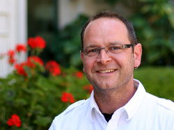
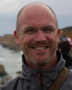
Speaker: Will McClintock

Will is originally from East Lansing, Michigan, and has studied Biology (B.S., Earlham College), Behavioral Ecology (M.S., University of Cincinnati), Psychology (M.A., Pacifica Graduate Institute) and Ecology, Evolution & Marine Biology (Ph.D., University of California Santa Barbara). He has worked in over a dozen countries to support marine spatial planning in the form of stakeholder-friendly decision support tools.

October 4 – Precipitation Variability Effect on Primary Production: experimentation, modelling and data synthesis from local to global scale

My talk is focused on responses of arid to sub-humid ecosystems to climate change. The main objective of my research is to study how interannual variability of precipitation affects patterns of primary production and to determine which mechanisms govern such responses. In order to investigate cause-effect relationships between precipitation variability and ecosystem response, I carry out a large-scale manipulative experiment, participate in modeling projects, and analyze worldwide long-term data set. Results from these efforts show that interannual precipitation variability itself has a strong effect on primary productivity and that this relationship is independent from the effects of precipitation amount. At the local scale, precipitation variability effects vary among plant-functional types; and, at the global scale, dry sites respond positively and mesic sites respond negatively to increases in interannual precipitation coefficient of variation.

Speaker: Laureano Gherardi

Laureno is an ecosystem ecologist interested in mechanisms governing ecosystem responses to climate change at multiple temporal and spatial scales. In order to pursue this research he combines different complementary approaches ranging from field manipulative experiments to modeling efforts to synthesis of long-term archived data.

August 23 – Acronyms are people too: (re)Defining the NCEAS identity and voice

Speaker: Jenny Seifert

NCEAS is in a unique position to clarify its identity and voice, a crucial priority for enhancing the center’s reach and influence, especially as it settles into the (arguable) 2.0 version of itself. New-ish communications officer Jenny Seifert will present on how NCEAS communications are evolving. Come prepared to participate in a discussion! Jenny doesn’t want to do all the talking.

Small homework assignment: Is there a website you think is really slick and has some relevance to NCEAS? There will be an opportunity during the Roundtable to share a website you really like that has elements NCEAS could emulate in its forthcoming website remodel.

July 12 – Wildnote: Harnessing Technology to Support Citizen Scientists

Speaker: Kristen Hazard

Kristen Hazard, Wildnote’s founder and chief programmer will share the Wildnote story and give an app overview, while Renee Punzi and Nancy Douglas will talk about Wildnote’s current citizen sciene efforts on the Central Coast.

In 2011, Kristen Hazard, a principal at Terra Verde Environmental Consulting, built an environmental compliance reporting app for the powerhouse utility PG&E. The utility needed to comply with environmental regulations while building the infrastructure to accept power from the two huge solar projects in the Carrizo Plains. The app was so valuable to PG&E it started using it on all large construction projects. Over the last five years, PG&E has utilized the app to submit over 50,000 reports and upload over 300,000 photos from more than 600 users from 30 companies. PG&E continues to use the application to meet its compliance reporting needs.

With this background, Kristen’s company, Suntoucher Software, recently created and launched a new app called Wildnote directed to the broader environmental community. Wildnote creates efficiencies in the process of collecting, managing, and reporting environmental data. This is a powerful tool that supports those who are directly involved in the hard work of collecting and analyzing environmental data. The better data we have, the better decisions we can make.


May 24 – Better science in less time: How the Ocean Health Index is transforming marine science for management

For the past four years, we have dramatically improved how we work with the Ocean Health Index by embracing open data science practices and tools. We now work in a way that is more reproducible, transparent, collaborative, and open, with more emphasis on communication. Our work is more reproducible and streamlined, and more than 20 countries around the world are building off our science and our code to assess ocean health in their own jurisdictions.

We’re sharing our story because at the time we thought this transformation was intimidating, but we are living proof that it’s possible. By describing specific tools and how we incrementally began using them for the Ocean Health Index project, we hope to encourage others in the scientific community to do the same — so we can all produce better science in less time.

Speaker: Julie Stewart Lowndes

Julie is a marine biologist working to bridge science and resource management. In her role as project scientist for the Ocean Health Index, Julie facilitates the adaptation of the OHI+ assessment framework to smaller spatial scales relevant to marine policy. She leads trainings internationally and provides conceptual and technical support for independent OHI assessments.

Prior to joining the Index team, Julie completed her Ph.D dissertation at Stanford University’s Hopkins Marine Station, researching potential effects of the Humboldt squid in the California Current System on coastal fisheries in a changing climate.

May 17: Red fish, blue fish, where are you, fish?

Species distribution data provide the foundation for a wide range of ecological research studies and conservation management decisions. Two major efforts to provide marine species distributions at a global scale are the International Union for Conservation of Nature (IUCN), which provides expert-generated range maps that outline the complete extent of a species’ distribution; and AquaMaps, which provides model-generated species distribution maps that predict areas occupied by the species. Together these databases represent 24,586 species (93.1% within AquaMaps, 16.4% within IUCN), with only 2,330 shared species. Differences in intent and methodology can result in very different predictions of species distributions, which bear important implications for scientists and decision makers who rely upon these datasets when conducting research or informing conservation policy and management actions. We illustrate the scientific and management implications of these tradeoffs by repeating a global analysis of gaps in coverage of marine protected areas, and find significantly different results depending on how the two datasets are used. By highlighting tradeoffs between the two datasets, we hope to encourage increased collaboration between taxa experts and large scale species distribution modeling efforts to further improve these foundational datasets, helping to better inform science and policy recommendations around understanding, managing, and protecting marine biodiversity.

You can explore an interactive web app of our results here: http://ohi-science.nceas.ucsb.edu/plos_marine_rangemaps/

Speaker: Casey O’Hara

Casey is a Researcher at NCEAS with the Ocean Health Index project as well as an educator, environmentalist, engineer, and musician. He studied climate change adaptation and mitigation, coastal marine resources, and environmental communication at UCSB’s Bren School and received his Master’s degree in 2014.  Long prior to Bren, he earned a B.S. and M.S. in Mechanical Engineering from Stanford in 1994.

May 10: The geography of spatial synchrony

Spatial synchrony, defined as correlated temporal fluctuations among populations, is a fundamental feature of population dynamics, but many aspects of synchrony remain poorly understood. Few studies have examined detailed geographical patterns of synchrony; instead most focus on how synchrony declines with increasing linear distance between locations, making the simplifying assumption that distance-decay is isotropic. By synthesizing and extending prior work, we show how geography of synchrony, a term which we use to refer to detailed spatial variation in patterns of synchrony, can be leveraged to understand ecological processes including identification of drivers of synchrony, a longstanding challenge. We focus on three main objectives: 1) showing conceptually and theoretically four mechanisms that can generate geographies of synchrony; 2) documenting complex and pronounced geographies of synchrony in two important study systems; and 3) demonstrating a variety of methods capable of revealing the geography of synchrony and, through it, underlying ecology. By documenting the importance of geographies of synchrony, advancing conceptual frameworks, and demonstrating powerful methods, we aim to help elevate the geography of synchrony into a mainstream area of study and application.

Speaker: Jon Walter

Jon Walter is an ecologist who uses long-term observations, theoretical and data-driven models, and experiments to examine spatiotemporal dynamics of populations and communities. He is currently a postdoctoral researcher affiliated with Virginia Commonwealth University and the University of Kansas, where he is working on projects related to spatial synchrony and insect outbreaks. He obtained his PhD from the University of Virginia in 2014, where his dissertation research focused on spatiotemporal patterns in the gypsy moth invasion.

April 19: (Non)parallel evolution in salmon

Among recent studies of parallel and convergent evolution, appreciation is growing for the ubiquity and importance of non-parallelism, or variation in the extent of parallelism due to differences in the direction or magnitude of divergence among ecotype pairs. In this talk, I’ll first discuss a recent review of studies of parallel evolution in fishes with the goal of determining just how parallel is parallel evolution? Next, I’ll explore two potential drivers of non-parallelism, sexual selection and evolutionary history, in two salmon species. Finally, I’ll briefly outline our NCEAS SASAP working group project on declines in salmon size and age in Alaska. Overall, I hope to highlight the variable extent of parallelism in studies of ostensibly parallel evolution and the value of investigating sources of variation among evolutionary replicates.

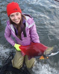
Speaker: Krista Oke

Krista is a graduating PhD student from Andrew Hendry’s lab at McGill University, Montreal, where she studied (non)parallel evolution in fishes. Previously, she completed her honours research on hybrids between brown trout and genetically modified Atlantic salmon at Memorial University of Newfoundland, under the supervisor of Ian Fleming. Next month, she will begin a postdoc with Eric Palkovacs at UCSC, as part of an NCEAS SASAP working group project focused on declining salmon size and age in Alaska.

April 5: Inferring species presence using environmental DNA

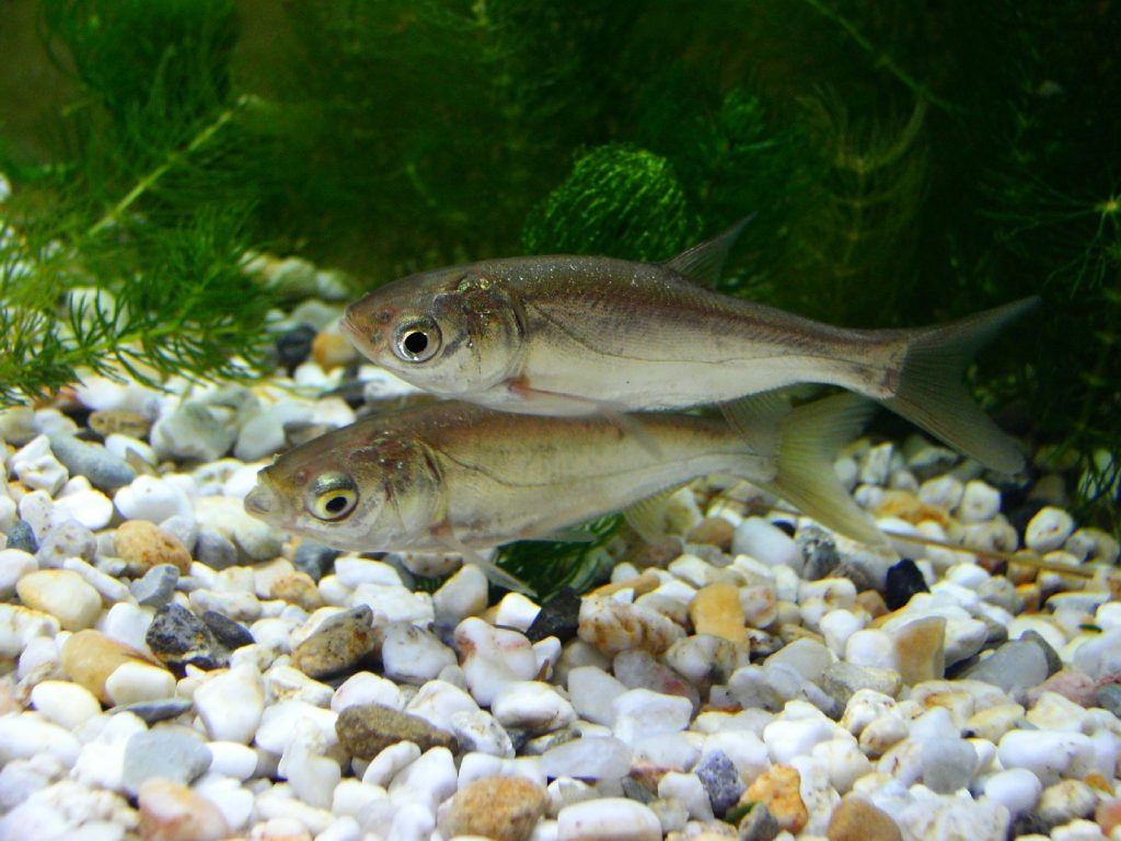
One of the great challenges with aquatic conservation is knowing what species are present below the water’s surface.  This is particularly true for rare species such as newly arrived non-indigenous species and threatened and endangered species. A new approach to species detection, coined environmental DNA (eDNA), uses the telltale genetic signature of aquatic species in the form of tissue, cells, organelles, and DNA fragments in the water that are captured and extracted to infer presence.  First generation applications of the eDNA methodology were applied to early detection of invasive species, but now the approach is being used to identify entire communities. In this discussion, we will explore the evolution of inferring species presence using environmental DNA, from the original detections of Bighead and Silver Carp in the Great Lakes to the attempts at estimating species richness. Throughout the development of eDNA approaches, mathematical and statistical models have motivated the sampling design and quantification of errors, and these models have ultimately driven inferences of species presence. The resulting growth in eDNA applications is leading to a new era in globally mapping the distribution and identity of species for improved aquatic conservation and management.

Speaker
Christopher Jerde
Marine Science Institute, University of California Santa Barbara

Christopher Jerde grew up fishing and camping among the prairie pothole lakes of northeastern South Dakota. He completed his B.Sc. (2008) and M.Sc. (2002) at Montana State University surrounded by open spaces and trout. While Montana cultivated a keen interest in ecology, his experiences studying bison population dynamics motivated him to build a broader quantitative background, and he migrated north to the Centre for Mathematical Biology at the University of Alberta where he completed his Ph.D. (2008).  As a postdoctoral fellow and a research assistant professor at the University of Notre Dame, Chris led the development of an environmental DNA surveillance program for invasive species, most notably searching for Bighead and Silver Carp. Now at UCSB’s Marine Science Institute, Chris’s research program emphasizes the application of novel quantitative, field, and laboratory approaches coupled with emerging technology to address pressing environmental problems.

March 15 – Non-climate processes and ‘species on the move’

Evidence from the past several decades shows that species distributions are shifting in response to climate change. However, even the most robust studies attribute less than half of observed changes in species distributions to local climate factors. Foundational ecology considers climate as just one of many drivers that determine species distributions. I will review five prevalent mechanisms that may explain some of the high variance around the relationship between species range shifts and climate velocity, and describe how they might affect a species’ climate tracking: (1) biogeographic boundaries, (2) habitat gaps and fragmentation, (3) biotic interactions such as competition, predation, and mutualism, (4) other abiotic constraints including light and trace elements, and (5) life history traits that determine dispersal capacity. This work supports conservation initiatives for threatened species by highlighting several processes that may limit their potential redistribution, and can inform analyses of observational data and species distribution models that seek to incorporate multiple processes rather than climate alone.


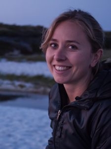
Alexa Fredston-Hermann
fredstonhermann@ucsb.edu

Alexa is a third-year PhD student at the Bren School of Environmental Science & Management at UCSB. Her research focuses on biogeographic processes that may prevent species from tracking climate change, particularly in the oceans. She has also studied human impacts to coastal marine ecosystems, and participated in the Ridges to Reef Fisheries SNAPP Working Group. Before entering graduate school, she worked for the Environmental Defense Fund on management of the West Coast groundfish fishery, and graduated from Princeton University in 2012 with a B.A. in Ecology and Evolutionary Biology.